 Catalalogue de l'ORE OMERE
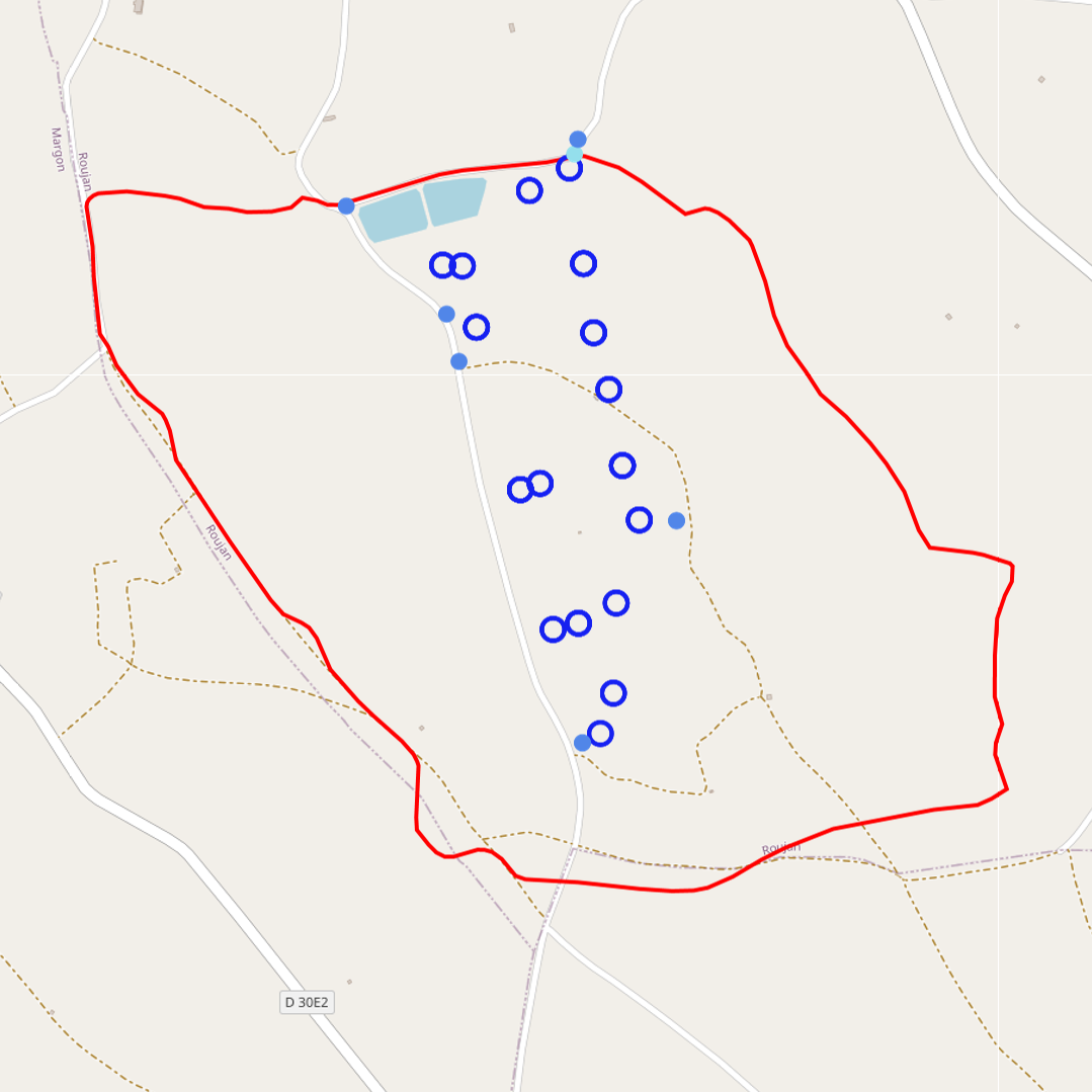
Water isotope analysis of precipitations, runoff and underground waters (Roujan)
Isotope analysis of groundwater, rainfall and surface water in the Roujan watershed area.
Samples of rainfall accumulated over a day or an event as well as instantaneous samples of runoff and groundwater are sent to a specialized laboratory to determine their oxygen 18 and deuterium contents.
Simple
- Date ( Creation )
- Date ( Publication )
- Date ( Revision )
- Status
- On going
https://www.umr-lisah.fr/?q=fr/content/c-coulouma
- thesaurus_localisation_omere ( Place )
-
- Roujan
- GEMET - INSPIRE themes, version 1.0 ( Theme )
-
- Environmental monitoring facilities
- theme.hydrology_unesco.rdf ( Theme )
-
- Water balance
- Water resources
- Groundwater
- Earth sciences
- Hydrological networks
- Surface water
- Hydrological cycle
- Hydrology education
- Hydrology
- Fluid mechanics
- Hydrological measurement
- Hydrological research
- UNESCO Thesaurus UNESCO Thesaurus ( Theme )
-
- Isotopes
- Groundwater
- Rain
- Surface water
Resource constraints
- Access constraints
- Intellectual property rights
- Use limitation
- Free use subject to compliance with the OMERE Observatory data use charter available on this form and also digitally signed when downloading data via the OMERE portal.
- Description
- Roujan
))
- Distribution format
-
-
utf8
(
1
)
-
utf8
(
1
)
- OnLine resource
- Roujan data portal ( WWW:LINK-1.0-http--link )
- OnLine resource
- Charter for the use of OMERE Observatory data ( WWW:LINK-1.0-http--link )
- OnLine resource
-
roucnt21311_l93
(
OGC:WMS-1.3.0-http-get-capabilities
)
Geographical layer of the contour of the Roujan catchment area
- OnLine resource
-
fr_tracage_isotopique
(
OGC:WMS-1.1.1-http-get-capabilities
)
Visualisation of the geographical layer of water sampling points (underground, surface, rain) for the analysis of water isotopes in Roujan
- File identifier
- e2f6bb8a-d60e-4bed-b9e8-cb13c1642d3c XML
- Metadata language
- fr
- Parent identifier
- Observation site of the Roujan's catchment (Herault / France) 1c37c878-e4cc-4137-8556-11561b4d91a1
- Date stamp
- 2022-12-01T13:53:41
https://www.umr-lisah.fr/?q=fr/content/a-dubreuil
Overviews
Spatial extent
Provided by
