 Catalalogue de l'ORE OMERE
Observation site of the Roujan's catchment (Herault / France)
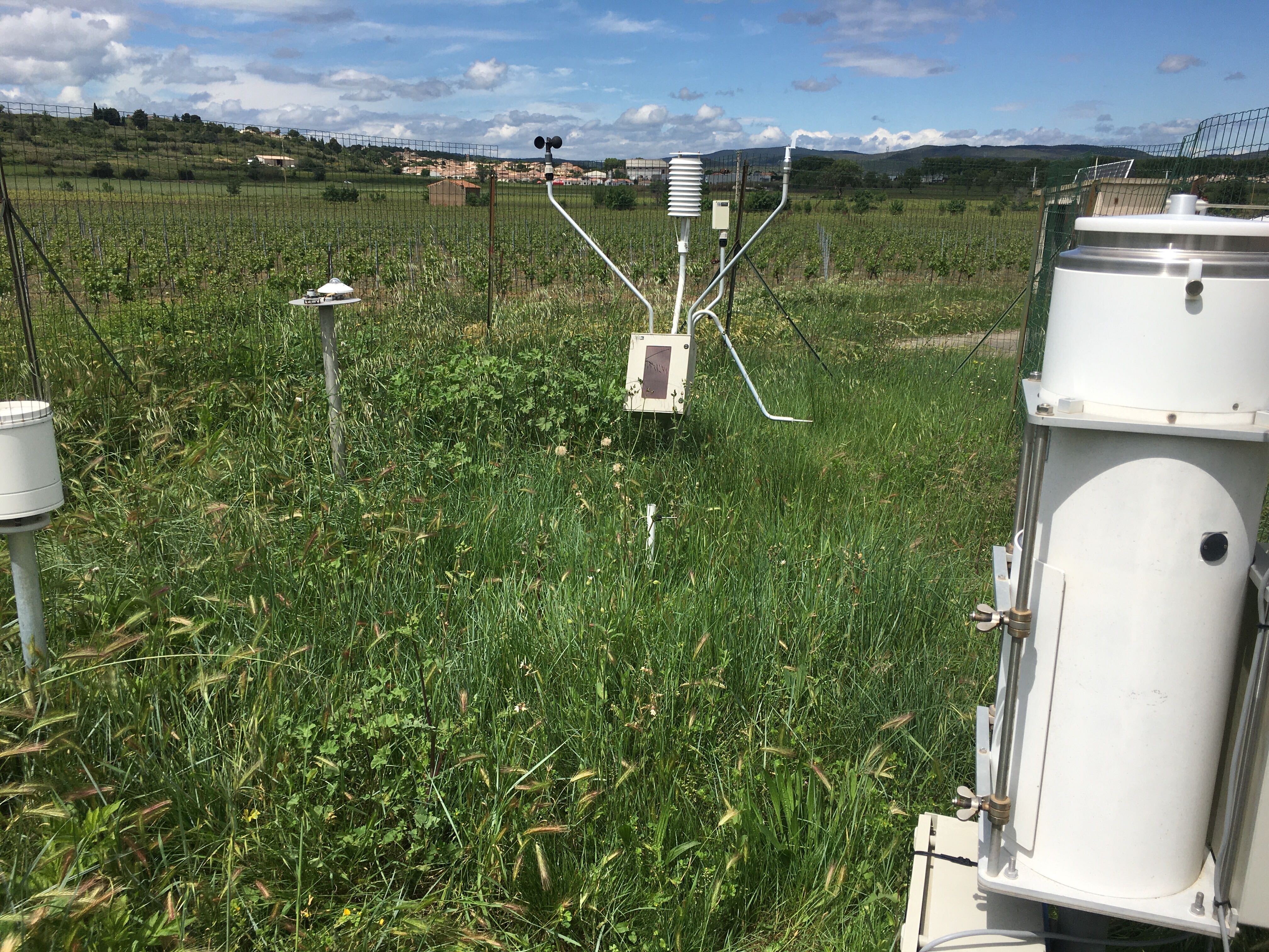
The main crop is the vine. The site is strongly anthropised (network of ditches, terraced slopes, etc.). The climate is sub-humid Mediterranean with a prolonged dry season. The average annual rainfall is around 650 mm and the average annual ETP (Penman) is 1090 mm. The basic hydro-meteorological equipment, in place since May 1992, consists of a network of 9 rain gauges and 4 pluviographs, a device for measuring water table heights (14 sites), a device for measuring flows, suspended matter and pesticides at the outlets of the catchment area and of two plots with different cultivation routes and a network of 8 stations for measuring soil water content and water potential. Roujan was part of the reference catchment area network of the Network Observation Service Used for Hydrology Research created by the GIP Hydrosystème.
Simple
- Date ( Creation )
- Date ( Publication )
- Date ( Revision )
- Status
- On going
Custodian
INRAE - GC
-
Roujan site manager
(
Administrateur du Système d'Informations
)
https://www.umr-lisah.fr/?q=fr/content/c-coulouma
2, place Pierre Viala
,
Bâtiment 24
,
Montpellier
,
34060
,
France
+33499613074
https://www.umr-lisah.fr/?q=fr/content/c-coulouma
Principal investigator
ORE OMERE
-
Scientific Coordinators
(
Scientific coordination of the Observatory
)
2, place Pierre Viala
,
Bâtiment 24
,
Montpellier
,
34060
,
France
https://www.obs-omere.org/fr/organisation
- Keywords
-
- Keywords
-
- thesaurus_localisation_omere ( Place )
-
- Roujan
- theme.agricultral_land.rdf ( Theme )
-
- Agronomy
- Cultivation
- Soil resources
- Agricultural land
- GEMET - INSPIRE themes, version 1.0 ( Theme )
-
- Soil
- Land use
- Land cover
- Hydrography
- Geology
- Environmental monitoring facilities
- theme.hydrology_unesco.rdf ( Theme )
-
- Hydrology
- Fluid mechanics
- Groundwater
- Ecohydrology
- Hydrological cycle
- Hydrology education
- Surface water
- Hydrological measurement
- Hydrosphere
- Hydrogeology
- Water balance
- Earth sciences
- Access constraints
- Copyright
- Description
- Roujan
N
S
E
W
))
- Distribution format
-
-
utf8
(
1
)
-
utf8
(
1
)
- OnLine resource
- portail de données de Roujan ( WWW:LINK-1.0-http--link )
- OnLine resource
- Description of the Roujan site (omere website) ( WWW:LINK-1.0-http--link )
- OnLine resource
- Charter for the use of OMERE Observatory data ( WWW:LINK-1.0-http--link )
- File identifier
- 1c37c878-e4cc-4137-8556-11561b4d91a1 XML
- Metadata language
- fr
- Parent identifier
- The Mediterranean Observatory of Rural Environment and Water 72ed6284-5330-4921-a41e-184609f01f14
- Date stamp
- 2021-03-02T15:25:32
Distributor
INRAE - AD
-
Arnaud DUBREUIL
(
Information System Administrator
)
https://www.umr-lisah.fr/?q=fr/content/a-dubreuil
2, place Pierre Viala
,
Bâtiment 24
,
Montpellier
,
34060
,
France
+33499612347
https://www.umr-lisah.fr/?q=fr/content/a-dubreuil
Overviews
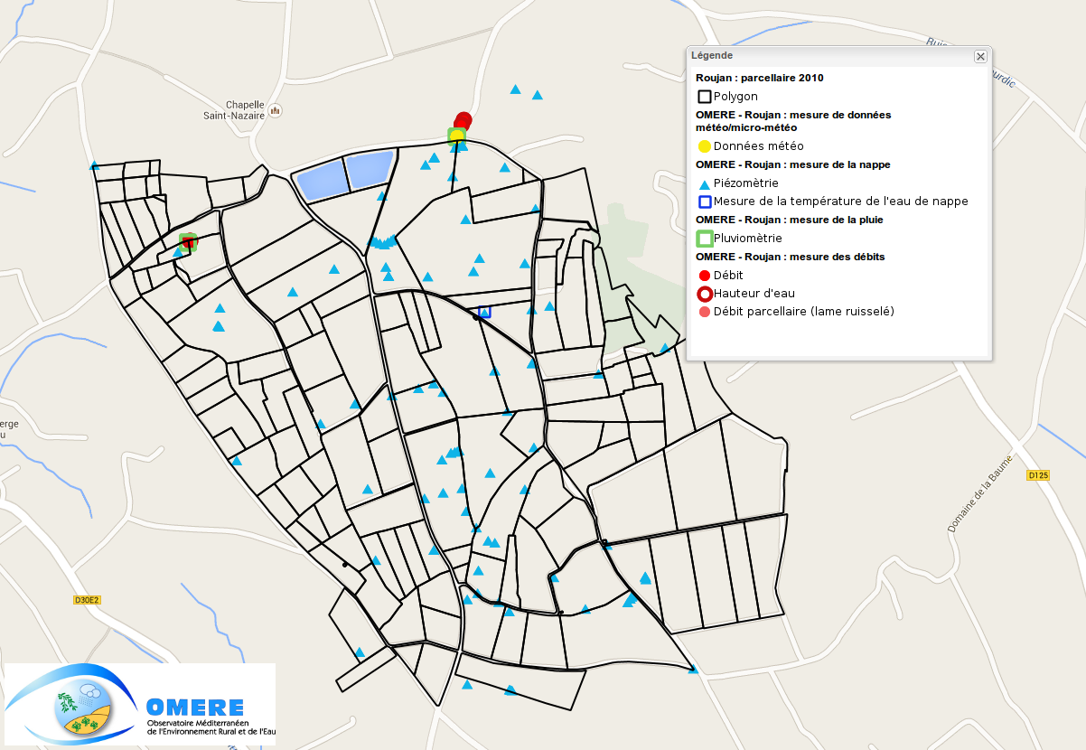
map of the measuring device at the Roujan site
Spatial extent
N
S
E
W
Provided by

Associated resources
Not available