 Catalalogue de l'ORE OMERE
Type of resources
Available actions
Topics
Keywords
Contact for the resource
Provided by
Formats
Representation types
Update frequencies
status
Scale
-
The physico-chemical parameters measured in the Roujan basin and accessible via the data portal concern the measurement of elements such as pH, redox potential, temperature and conductivity, carried out during sampling in the basin.
-
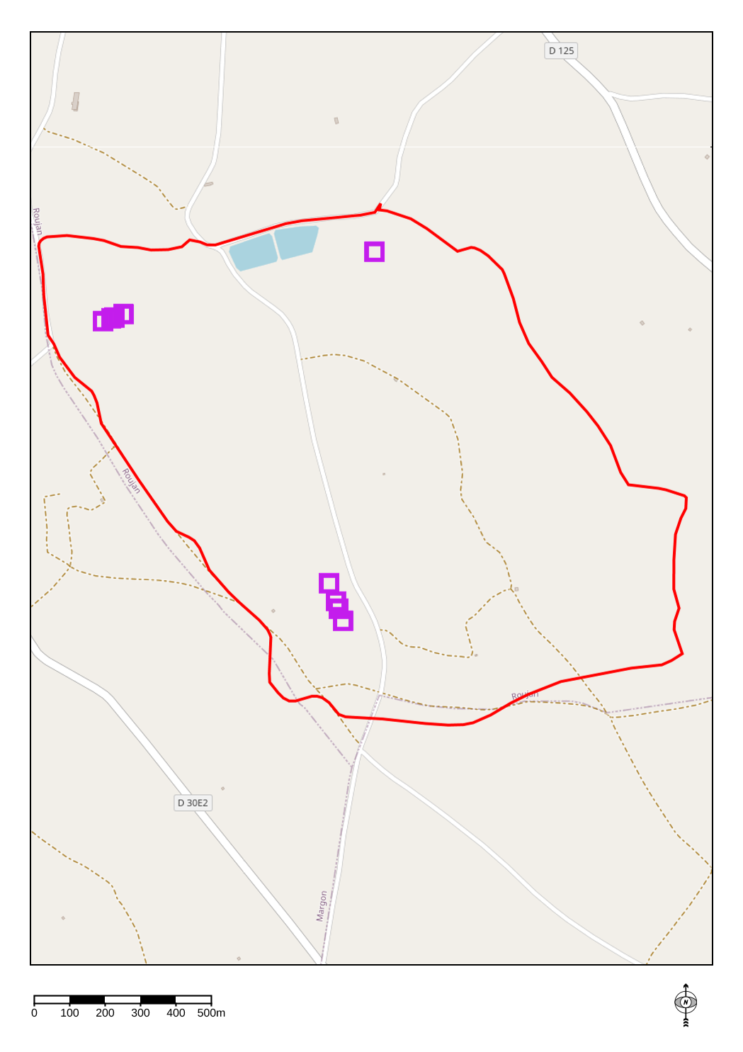
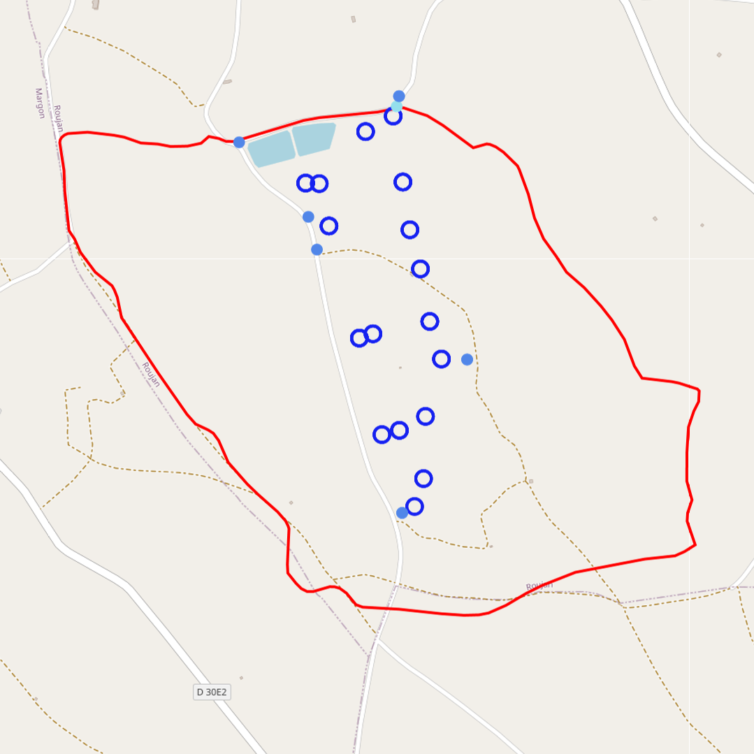
The groundwater temperature is measured at different points in the Roujan catchment. In Roujan site, the groundwater is shallow with a free surface water table rising and falling in the soil and subsoil layers. The measurements are made at different points in the catchment with piezometers. A piezometer is a perforated PVC tube at its base installed in the soil through a borehole. In every piezometer, the groundwater temperature is monitored at high frequency (~15') with autonomous and automatic temperature probe integrating acquisition units. Through the OMERE data portal accessible from this website, the data can be downloaded from an interactive map.
-
-
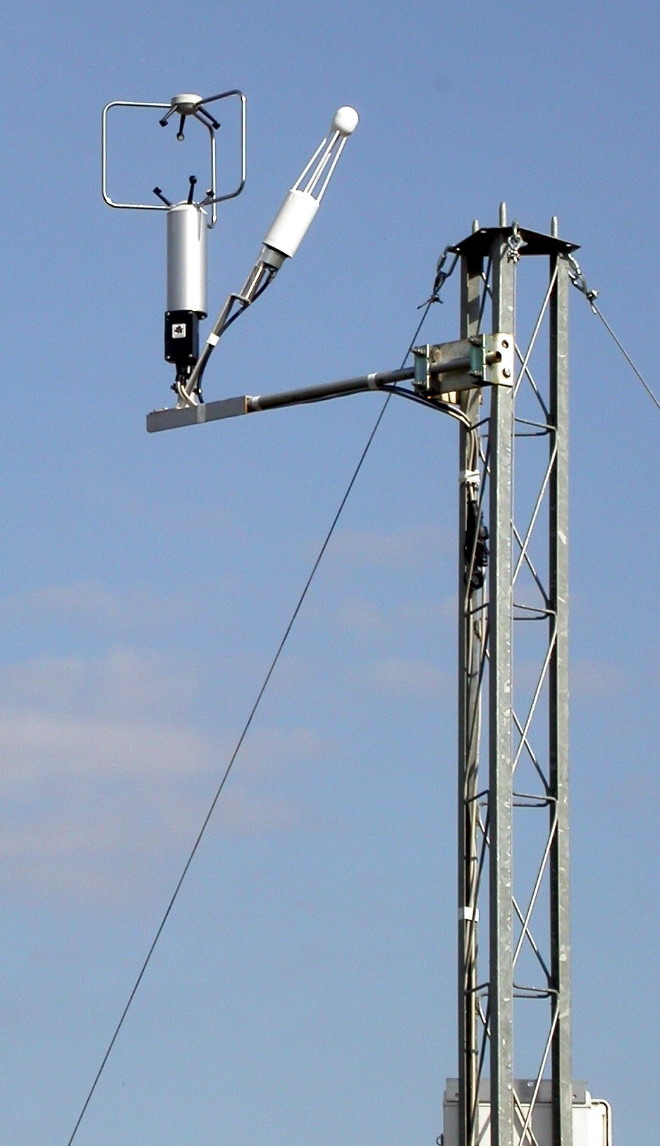
A flow tower is installed on the watershed of Roujan as well as a meteorological station of the AgroClim service unit (INRAE). At these points a set of sensors are arranged in order to collect various meteorological variables such as wind speed, air humidity and temperature, global radiation or evapotranspiration. Just like the other measurements made on the basin by sensors, data acquisition units record the values which are transmitted several times a day to our servers at the INRAE centre in Montpellier or retrieved via Agroclim's webservice. R routines are then used to process these data and prepare them for integration into the HYSAE database of the LISAH, thus integrating them into the information system for OMERE. Through the OMERE data web portal, the address of which is given in this fact sheet, the data can be consulted and downloaded.
-
The physico-chemical parameters measured in the Kamech basin and accessible via the data portal concern the electrical conductivity of the water.
-
The rainfall of the Roujan (Hérault) catchment area has been acquired since 1992 through various measuring points on which sensors are positioned on a long-term and continuous basis. The data from these sensors are directly recorded on servers in Montpellier through remote transmission. Verification treatments and possible corrections are applied before the data sets are integrated into the HYSAE database. Through the OMERE data portal accessible from this sheet, the data can be downloaded from an interactive map. In addition to these raw data rainfall records, a so-called "synthetic" time serie is elaborated to provide a complete and uninterrupted chronicle of rainfall data representative for the catchment area.
-
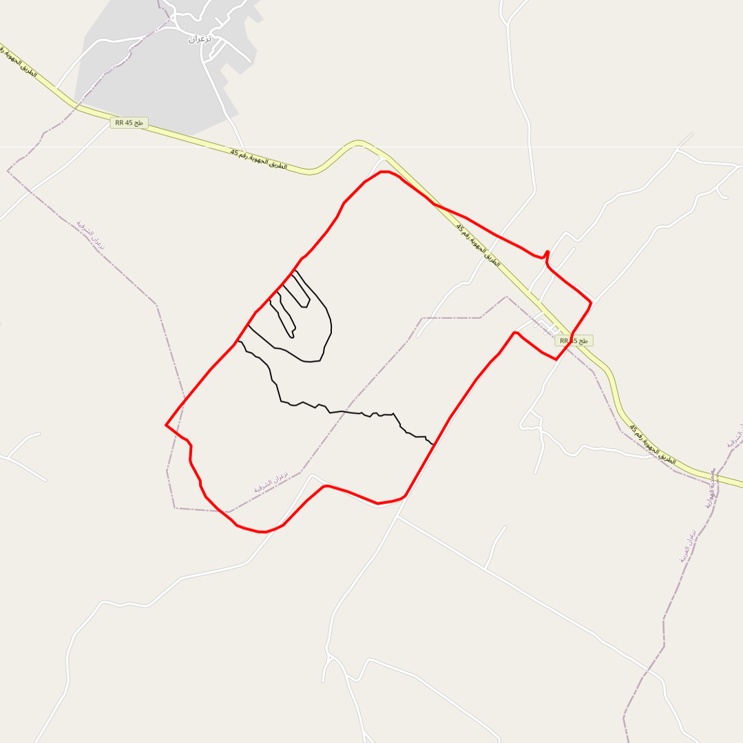
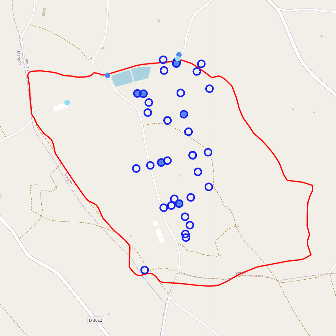
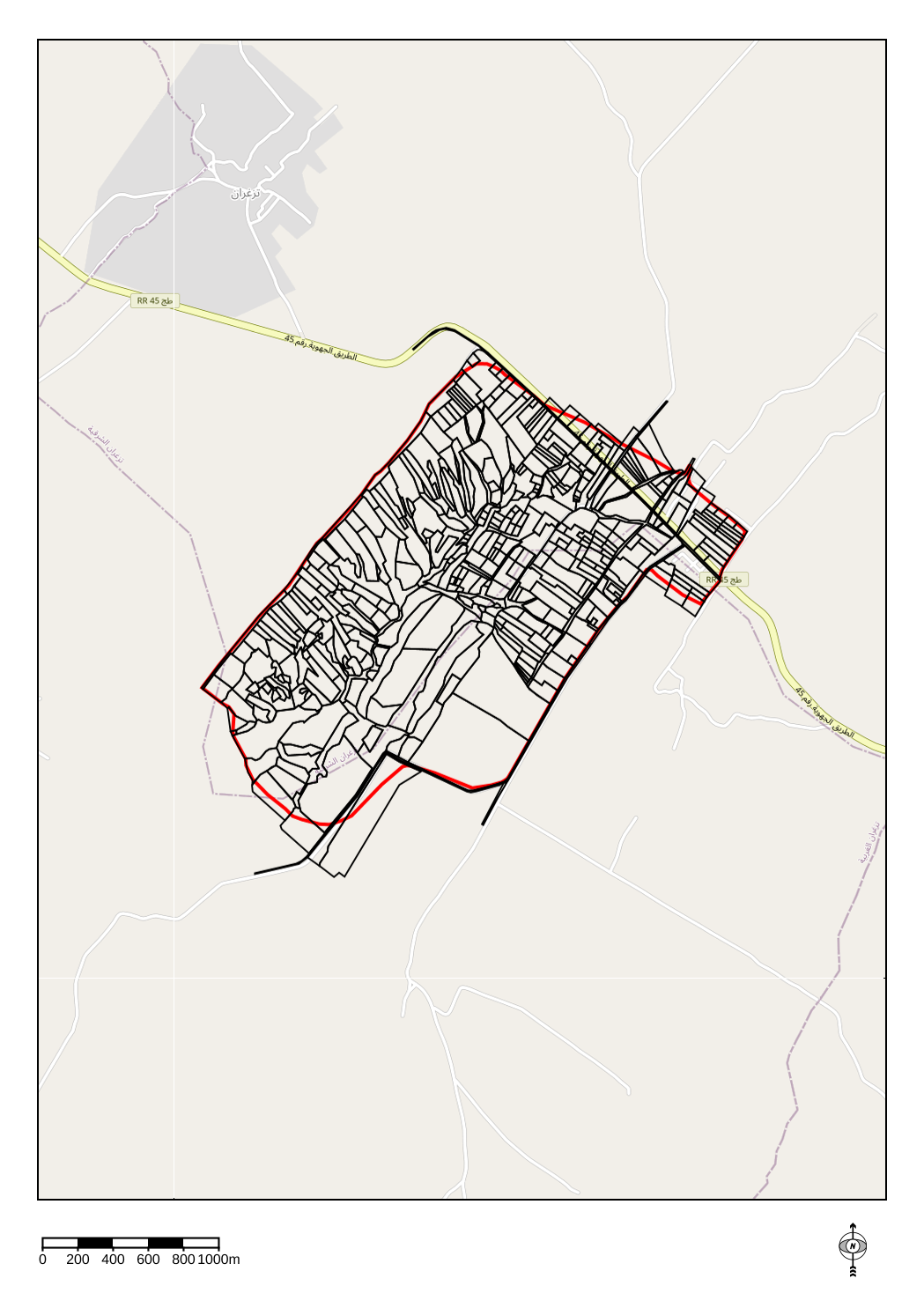
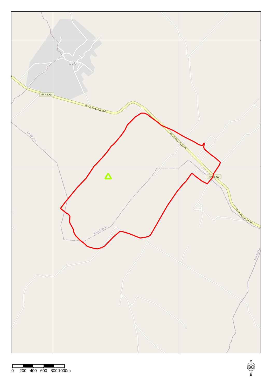
Limits of the impluviums of : - the wadi - the agronomic plot - the gully - the Kamech micro-basin
-
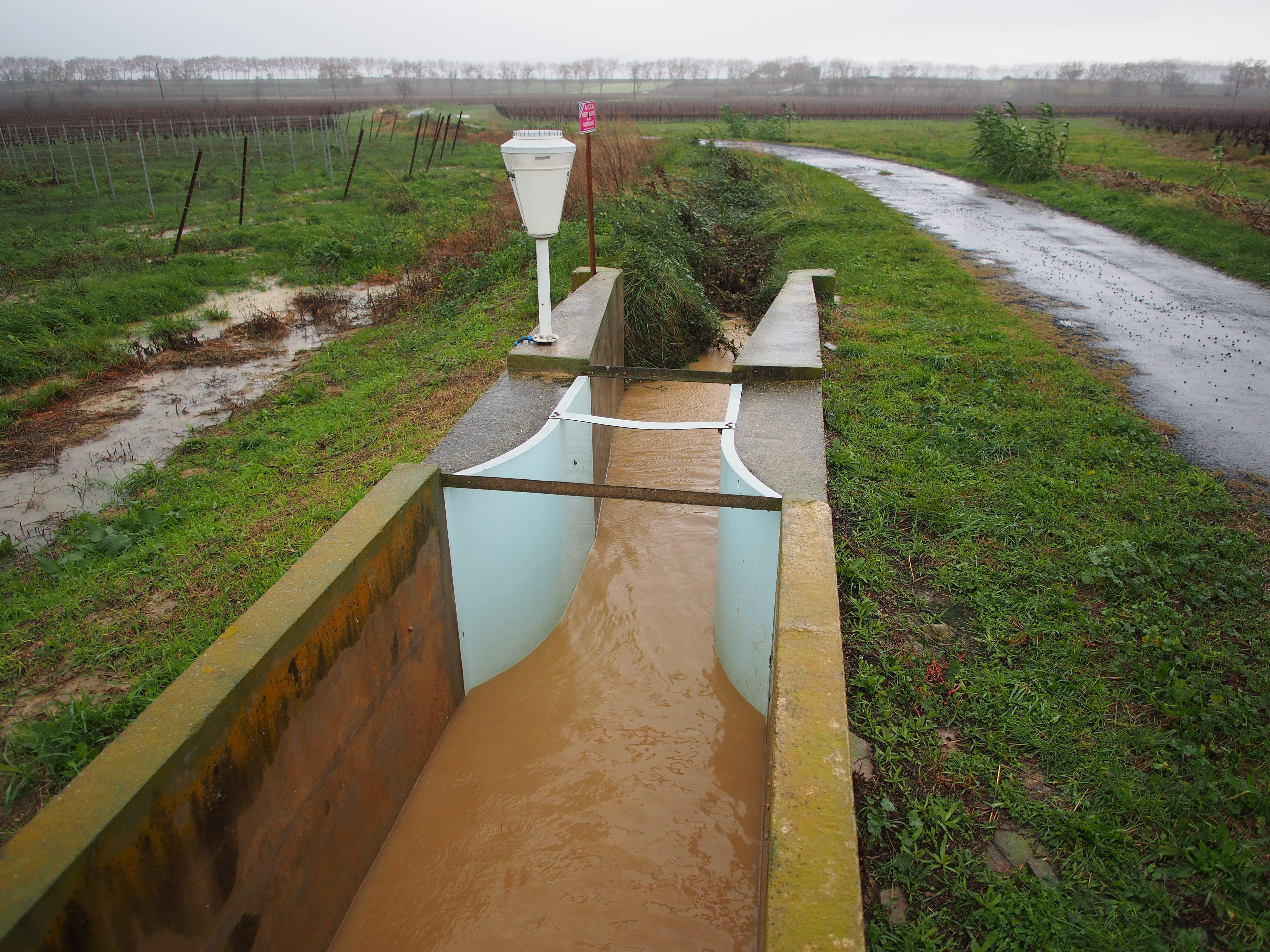
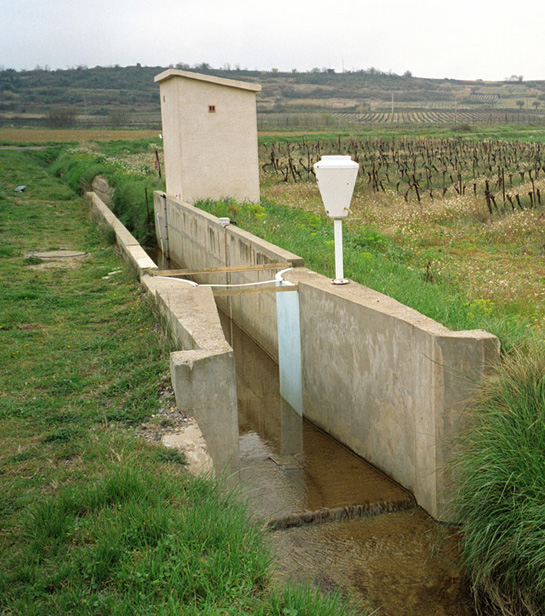
Runoff and stream flow discharge monitoring in the Roujan catchment area (Hérault) is operational since 1992 at catchment and sub-catchments hydrological stations on which automatic sensors records water level time series on a long-term and continuous basis. The data from these sensors are collected and instantaneously transmitted to servers in Montpellier. Verification and correction processes on the raw data, as well as the generation of elaborated data (e.g. calculation of flows from water heights or modification of time steps) are applied before integration of the data sets into the HYSAE database. The water level and discharge time series can be downloaded from an interactive map through the OMERE data portal accessible from this page.
-
The evaluation of soil moisture in different areas of the Roujan catchment area is carried out by measuring the moisture content of fresh soil samples.
-
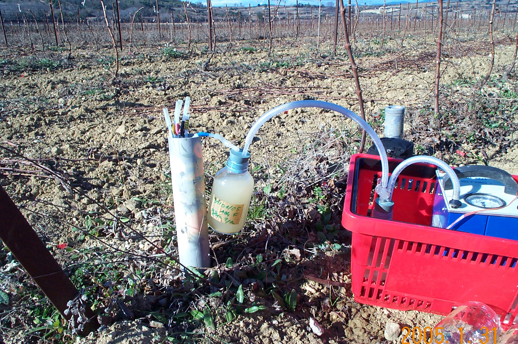
Isotope analysis of groundwater, rainfall and surface water in the Roujan watershed area. Samples of rainfall accumulated over a day or an event as well as instantaneous samples of runoff and groundwater are sent to a specialized laboratory to determine their oxygen 18 and deuterium contents.