 Catalalogue de l'ORE OMERE
series
Type of resources
Keywords
Contact for the resource
Provided by
status
-
OMERE is part of the study of global changes affecting Mediterranean hydro-agrosystems. It focuses on a hydrological context that is intermediate between arid and temperate environments and subject to a wide range of hydrological processes ranging from intense droughts to extreme floods, and on a social and human context that is currently undergoing considerable changes (intensification of agricultural production in favourable areas, abandonment of land that cannot be intensified, increase in catchment areas, hydro-agricultural or conservation developments) linked in particular to a rapid increase in population density. The various climate change scenarios developed by the IGCC predict major rainfall changes at these latitudes: a decrease in winter rainfall, an increase in stormy rainfall and extreme rainfall. In this context, the observatory is based on the acquisition of climatic, hydrological, sediment and solute flow records over the past two decades in two elementary Mediterranean catchment areas that are differentiated in terms of soils, hydro-agricultural developments, farming practices and their evolutionary dynamics: Roujan (France, mainly cultivated with vines) and Kamech (Tunisia, mixed farming). The observatory aims to i) understand the impact of agricultural activities on mass flows in elementary Mediterranean catchment areas: The observatory aims to i) understand the impact of agricultural activities on mass flows in elementary Mediterranean catchment areas: hydrological regimes and balances, allocation of water resources, erosion dynamics, changes in water quality; ii) assess the intensities and speeds of quantitative and qualitative changes in water and soil resources as a function of changes in land use; iii) support the development of approaches for modelling flows in cultivated areas; iv) provide scientific bases, references and diagnostic tools for agri-environmental engineering of cultivated landscapes OMERE is co-managed by four French and Tunisian laboratories (HSM, INAT, INRGREF, LISAH). It is part of several networks, including the OZCAR research infrastructure (https://www.ozcar-ri.org/), and is a stakeholder in the CRITEX project "National park of innovative equipment for the spatial and temporal study of the Critical Zone of Watersheds" selected by the Ministry in the framework of the 2nd wave of the call for projects "Investissement d'Avenir Equipements d'excellence".
-
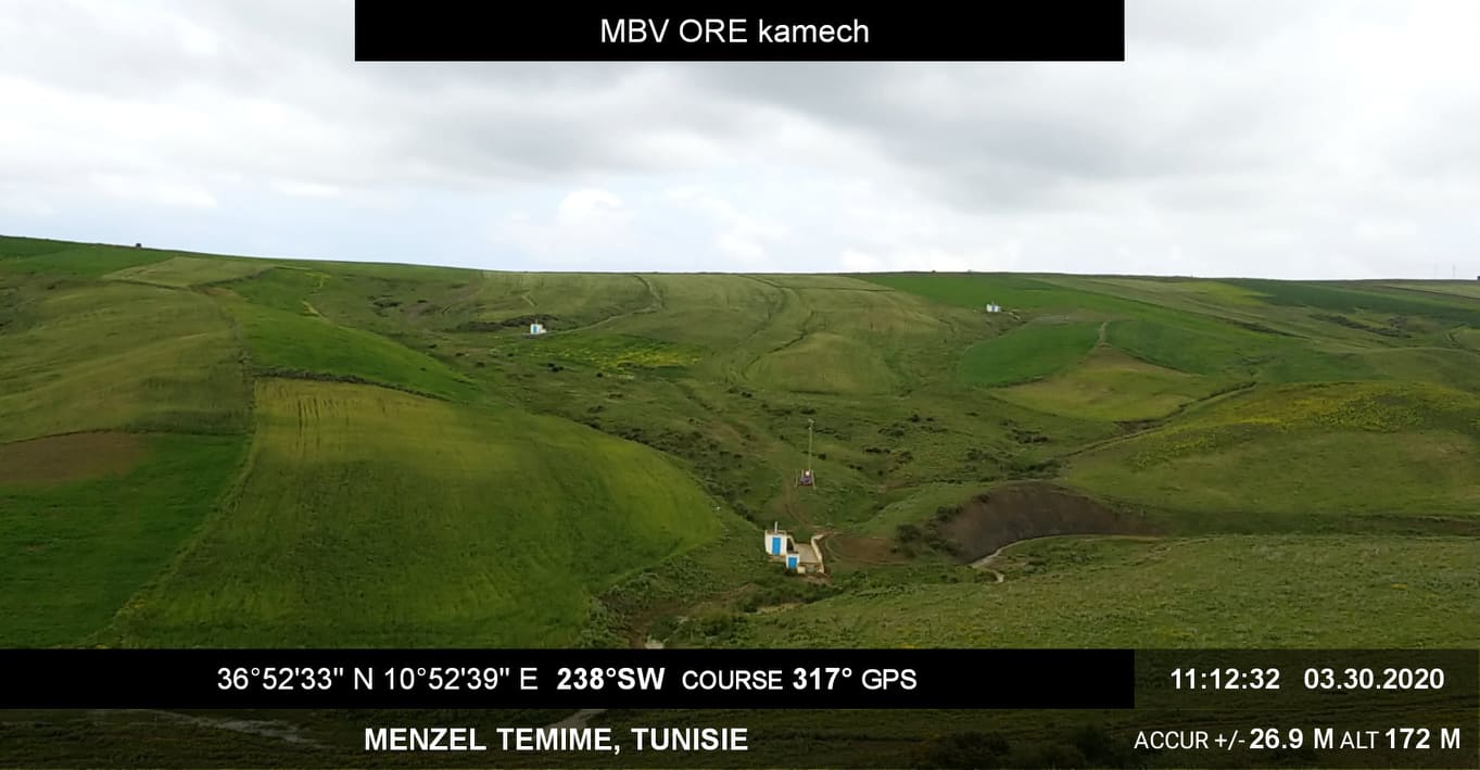
The Kamech basin is located north of Cap-Bon, in the governorate of Nabeul, on the border between the sub-humid and semi-arid Mediterranean climates. The average inter-annual rainfall is about 640 mm and the potential evapotranspiration is 1300 mm. The outlet of the basin is occupied by a hilly lake built in 1994 (140,000 m3 of initial capacity). The inter-annual flow coefficient is of the order of 10%-15% and the erosion of 15 t/ha/year. Land use is characterised by a cultivation rate close to 75% with, in order of importance: cereals, legumes and irrigated market gardening. This basin has been the subject of a monitoring of anthropogenic activities (land use and management, agricultural practices...), of agro-climatic variables, and of runoff and erosion since 1994 (+ pesticides more recently) at its outlet and since 2005 on 4 substations. This watershed is part of a network of 27 watersheds monitored under an agreement with the Tunisian Ministry of Agriculture (DGACTA).