 Catalalogue de l'ORE OMERE
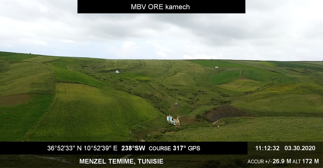
KAMECH long-term monitoring system (Cap Bon / Tunisie)
The Kamech basin is located north of Cap-Bon, in the governorate of Nabeul, on the border between the sub-humid and semi-arid Mediterranean climates. The average inter-annual rainfall is about 640 mm and the potential evapotranspiration is 1300 mm. The outlet of the basin is occupied by a hilly lake built in 1994 (140,000 m3 of initial capacity). The inter-annual flow coefficient is of the order of 10%-15% and the erosion of 15 t/ha/year. Land use is characterised by a cultivation rate close to 75% with, in order of importance: cereals, legumes and irrigated market gardening. This basin has been the subject of a monitoring of anthropogenic activities (land use and management, agricultural practices...), of agro-climatic variables, and of runoff and erosion since 1994 (+ pesticides more recently) at its outlet and since 2005 on 4 substations. This watershed is part of a network of 27 watersheds monitored under an agreement with the Tunisian Ministry of Agriculture (DGACTA).
Simple
- Date ( Creation )
- Date ( Publication )
- Date ( Revision )
- Status
- On going
Custodian
IRD - OG
-
Kamech site manager
(
Administrateur du Système d'Informations
)
https://www.umr-lisah.fr/?q=fr/content/o-grunberger
43 Avenue Charles Nicolle
,
INAT Tunisie
,
Tunis
,
1082
,
Tunisia
+216(0)92 643 163
https://www.umr-lisah.fr/?q=fr/content/o-grunberger
Principal investigator
ORE OMERE
-
Scientific Coordinators
(
Scientific coordination of the Observatory
)
2, place Pierre Viala
,
Bâtiment 24
,
Montpellier
,
34060
,
France
https://www.obs-omere.org/fr/organisation
- Keywords
-
- Keywords
-
- Keywords
-
- thesaurus_localisation_omere ( Place )
-
- Kamech
- theme.hydrology_unesco.rdf ( Theme )
-
- Water supply
- Hydrological measurement
- Hydrology education
- Hydrosphere
- Water balance
- Hydrogeology
- Groundwater
- Hydrology
- Surface water
- Fluid mechanics
- Ecohydrology
- Hydrological cycle
- GEMET - INSPIRE themes, version 1.0 ( Theme )
-
- Land cover
- Land use
- Environmental monitoring facilities
- theme.agricultral_land.rdf ( Theme )
-
- Land use
- Soil resources
- Cultivation
- Agronomy
- Access constraints
- Copyright
- Description
- Kamech
N
S
E
W
))
- OnLine resource
- Kamech portal data access ( WWW:LINK-1.0-http--link )
- OnLine resource
- Description of the Kamech site (omere website) ( WWW:LINK-1.0-http--link )
- OnLine resource
- Charter for the use of OMERE Observatory data ( WWW:LINK-1.0-http--link )
- File identifier
- 8995bb85-af1e-487d-8118-a01fb5fcdeb1 XML
- Metadata language
- fr
- Parent identifier
- The Mediterranean Observatory of Rural Environment and Water 72ed6284-5330-4921-a41e-184609f01f14
- Hierarchy level
- Series
- Hierarchy level name
- experimentalSiteLevel
- Date stamp
- 2021-03-25T08:36:27
Custodian
INRAE - AD
-
Arnaud DUBREUIL
(
Information System Administrator
)
https://www.umr-lisah.fr/?q=fr/content/a-dubreuil
2, place Pierre Viala
,
Bâtiment 24
,
Montpellier
,
34060
,
France
+33499612347
https://www.umr-lisah.fr/?q=fr/content/a-dubreuil
Overviews
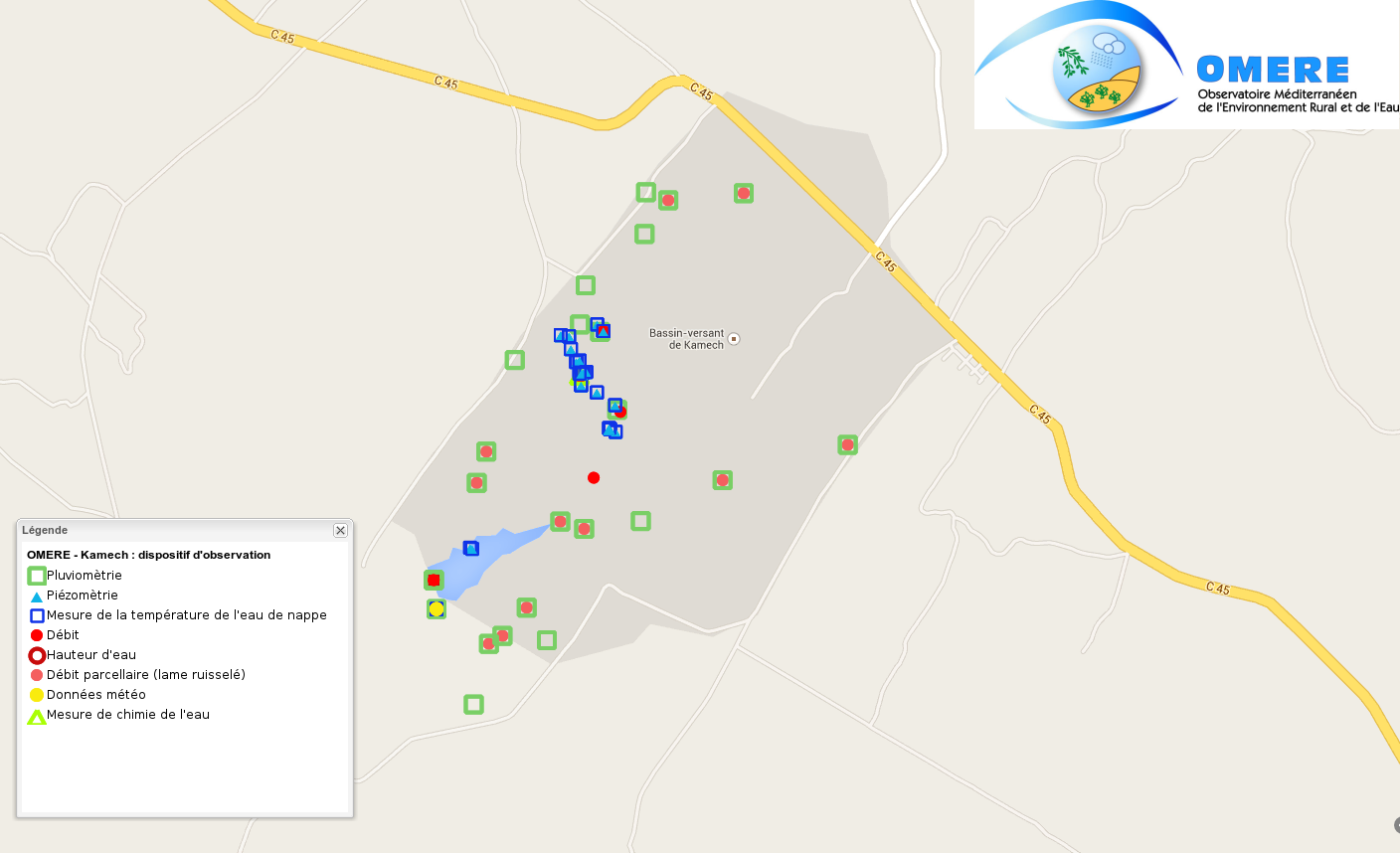
map of the measuring device at the Kamech site
Spatial extent
N
S
E
W
Provided by

Associated resources
Not available