 Catalalogue de l'ORE OMERE
Water temperature - Groundwater -Kamech site
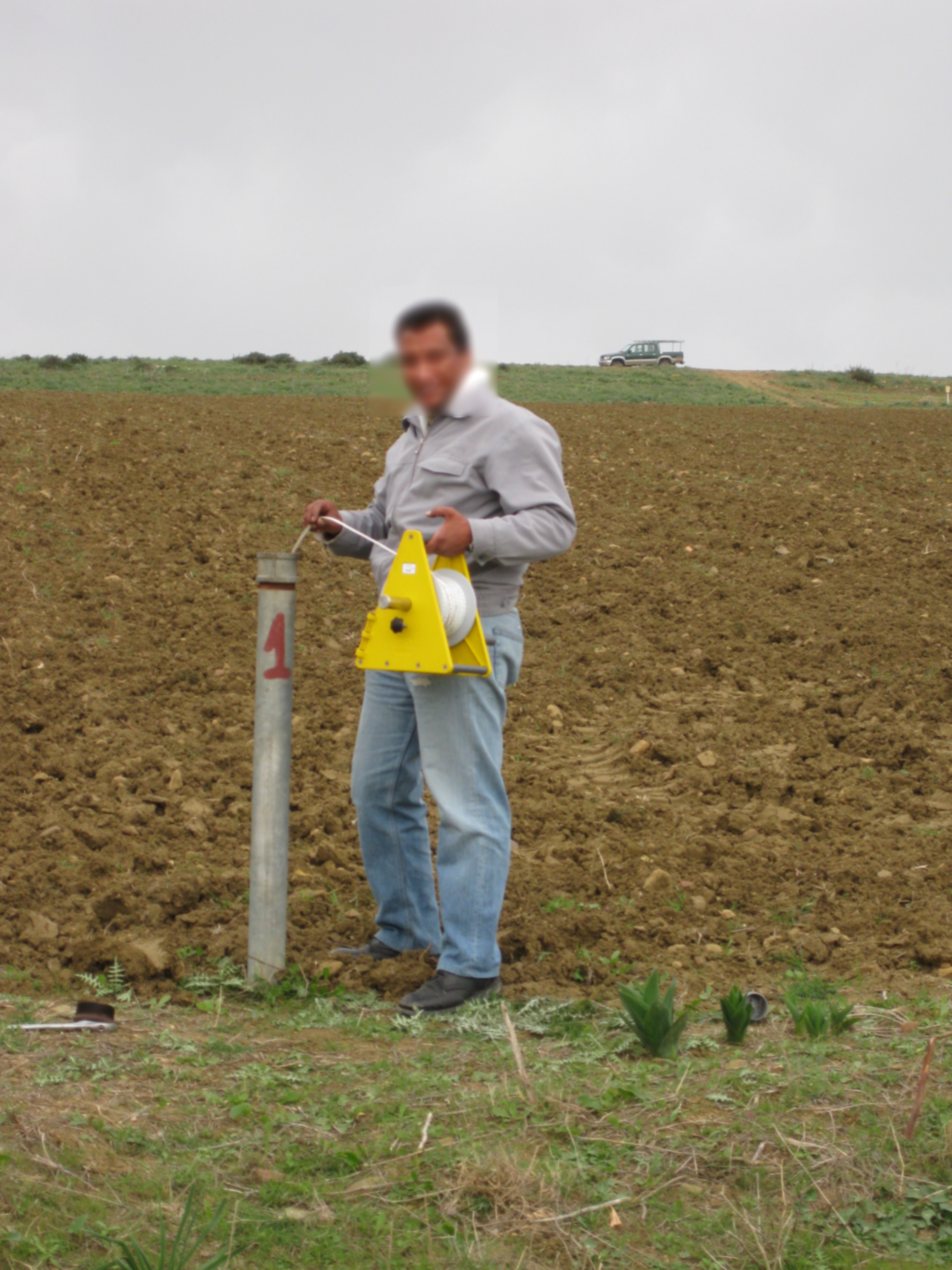
The groundwater temperature is measured at different points in the Kamech catchment. In Kamech site, the groundwater is shallow with a free surface water table rising and falling in the soil and subsoil layers. The measurements are made at different points in the catchment with piezometers. A piezometer is a perforated PVC tube at its base installed in the soil through a borehole. In every piezometer, the groundwater temperature is monitored at high frequency (~15') with autonomous and automatic temperature probe integrating acquisition units.
Through the OMERE data portal accessible from this website, the data can be downloaded from an interactive map.
Simple
- Date ( Creation )
- Date ( Publication )
- Date ( Revision )
- Status
- On going
https://www.umr-lisah.fr/?q=fr/content/o-grunberger
- Keywords
-
- Keywords
-
- thesaurus_localisation_omere ( Place )
-
- Kamech
- GEMET - INSPIRE themes, version 1.0 ( Theme )
-
- Hydrography
- Environmental monitoring facilities
- theme.hydrology_unesco.rdf ( Theme )
-
- Groundwater
- Hydrological measurement
- Hydrological research
- Ecohydrology
- Fluid mechanics
- Water resources
- Hydrology education
- Hydrogeology
- Hydrology
- Hydrological cycle
- Water balance
- Earth sciences
- UNESCO Thesaurus UNESCO Thesaurus ( Theme )
-
- Groundwater
- Hydrological networks
- Wells
- Hydrology education
- Hydrological measurement
- Hydrological research
- Hydrogeology
- Temperature
Resource constraints
- Access constraints
- Intellectual property rights
- Use limitation
- Free use subject to compliance with the OMERE Observatory data use charter available on this form and also digitally signed when downloading data via the OMERE portal.
- Description
- Roujan
))
- Distribution format
-
-
utf8
(
1
)
-
utf8
(
1
)
- OnLine resource
- Kamech data portal ( WWW:LINK-1.0-http--link )
- OnLine resource
- Charter for the use of OMERE Observatory data ( WWW:LINK-1.0-http--link )
- OnLine resource
-
limit_kamech_ltn
(
OGC:WMS-1.1.1-http-get-capabilities
)
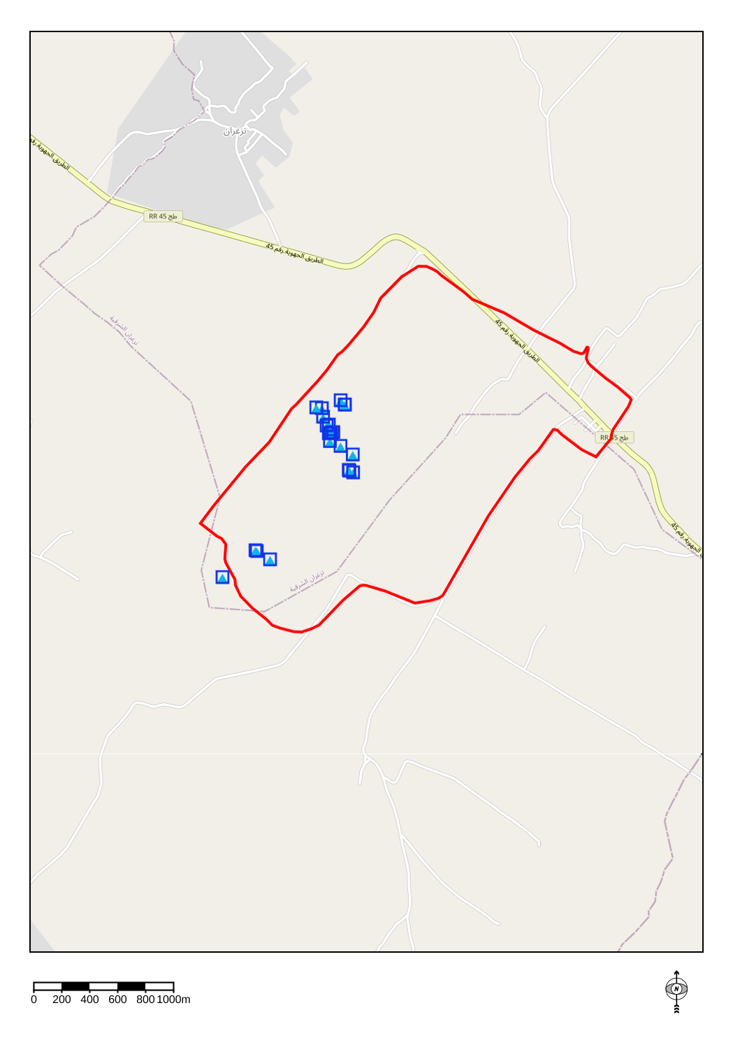
Geographical layer of the contour of the Kamech catchment area
- OnLine resource
-
tn_nappe
(
OGC:WMS-1.1.1-http-get-capabilities
)
Geographical layer of measuring points related to the water table of the Kamech catchment area
- OnLine resource
- Groundwater - Water table depth - Kamech Site ( WWW:LINK-1.0-http--link )
- File identifier
- 7e173a08-c407-411e-9ce7-977be821dde0 XML
- Metadata language
- fr
- Parent identifier
- KAMECH long-term monitoring system (Cap Bon / Tunisie) 8995bb85-af1e-487d-8118-a01fb5fcdeb1
- Date stamp
- 2021-04-13T09:50:26
https://www.umr-lisah.fr/?q=fr/content/a-dubreuil
Overviews
Spatial extent
Provided by
