 Catalalogue de l'ORE OMERE
Contents of trace metals in water (rain, run off, underground waters ) on the Roujan catchment area.
Regular sampling of surface water, rainwater or groundwater is carried out in the Roujan catchment area.
These samples are sampled and analysed in order to assess the content of trace metals in the waters of the basin.
Simple
- Date ( Creation )
- Date ( Publication )
- Date ( Revision )
- Status
- On going
https://www.umr-lisah.fr/?q=fr/content/c-coulouma
- Keywords
-
- Eau, Concentrations, Elements traces, Métaux
- Keywords
-
- thesaurus_localisation_omere ( Place )
-
- Roujan
- GEMET - INSPIRE themes, version 1.0 ( Theme )
-
- Environmental monitoring facilities
- theme.hydrology_unesco.rdf ( Theme )
-
- Water balance
- Surface water
- Hydrological cycle
- Groundwater
- Earth sciences
- Hydrological networks
- Hydrology education
- Hydrology
- Fluid mechanics
- Hydrological measurement
- Hydrological research
- UNESCO Thesaurus UNESCO Thesaurus ( Theme )
-
- Water pollution
Resource constraints
- Access constraints
- Intellectual property rights
- Use limitation
- Free use subject to compliance with the OMERE Observatory data use charter available on this form and also digitally signed when downloading data via the OMERE portal.
- Description
- Roujan
))
- Distribution format
-
-
utf8
(
1
)
-
utf8
(
1
)
- OnLine resource
- Roujan data portal ( WWW:LINK-1.0-http--link )
- OnLine resource
- Charter for the use of OMERE Observatory data ( WWW:LINK-1.0-http--link )
- OnLine resource
-
roucnt21311_l93
(
OGC:WMS-1.3.0-http-get-capabilities
)
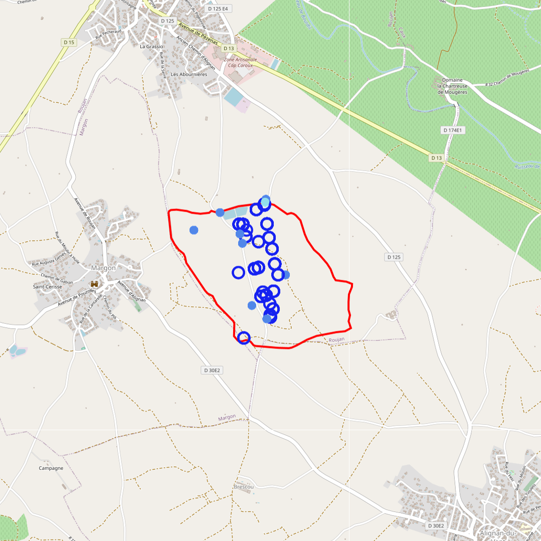
Geographical layer of the contour of the Roujan catchment area
- OnLine resource
-
fr_trace_metallique_eau
(
OGC:WMS-1.1.1-http-get-map
)
Geographical layer of the water sampling points in the Roujan catchment area, on which analyses of the content of metallic trace elements have been carried out.
- File identifier
- b94573bc-7993-48dd-827b-0e8bfac63e2e XML
- Metadata language
- fr
- Parent identifier
- Observation site of the Roujan's catchment (Herault / France) 1c37c878-e4cc-4137-8556-11561b4d91a1
- Date stamp
- 2022-12-01T14:39:01
https://www.umr-lisah.fr/?q=fr/content/a-dubreuil
Overviews
Spatial extent
Provided by
