 Catalalogue de l'ORE OMERE
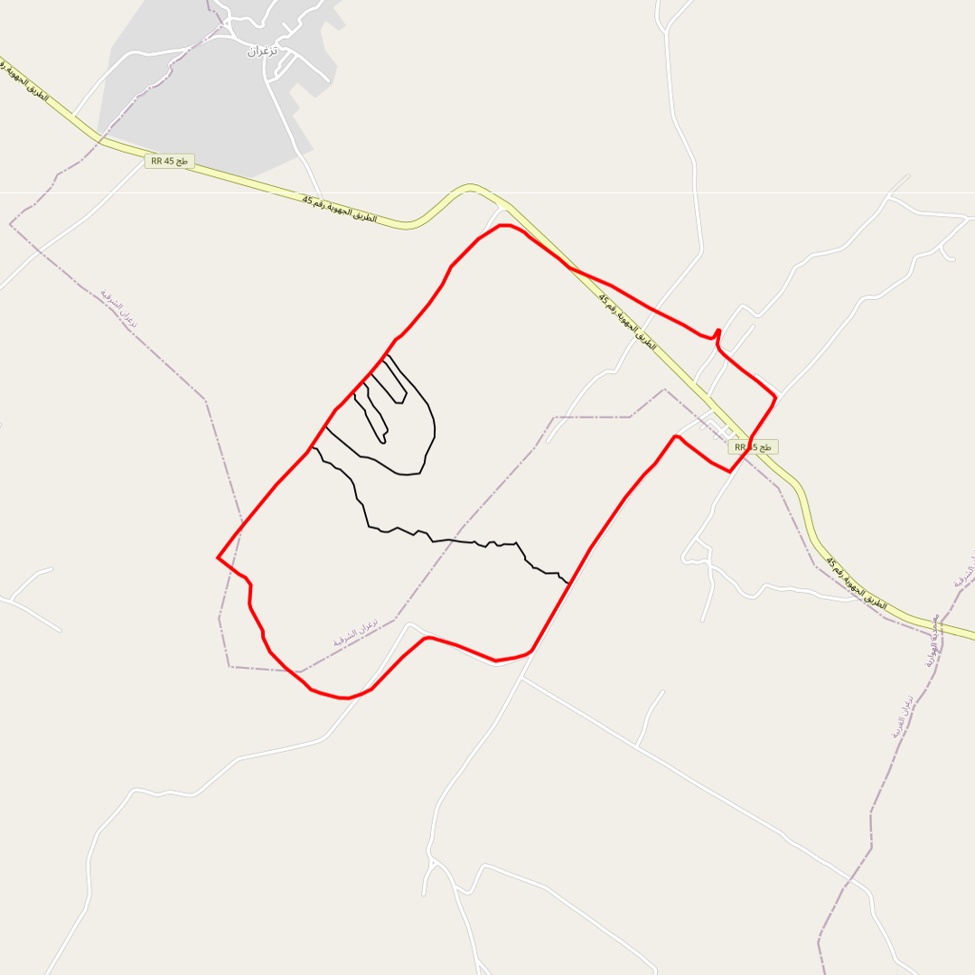
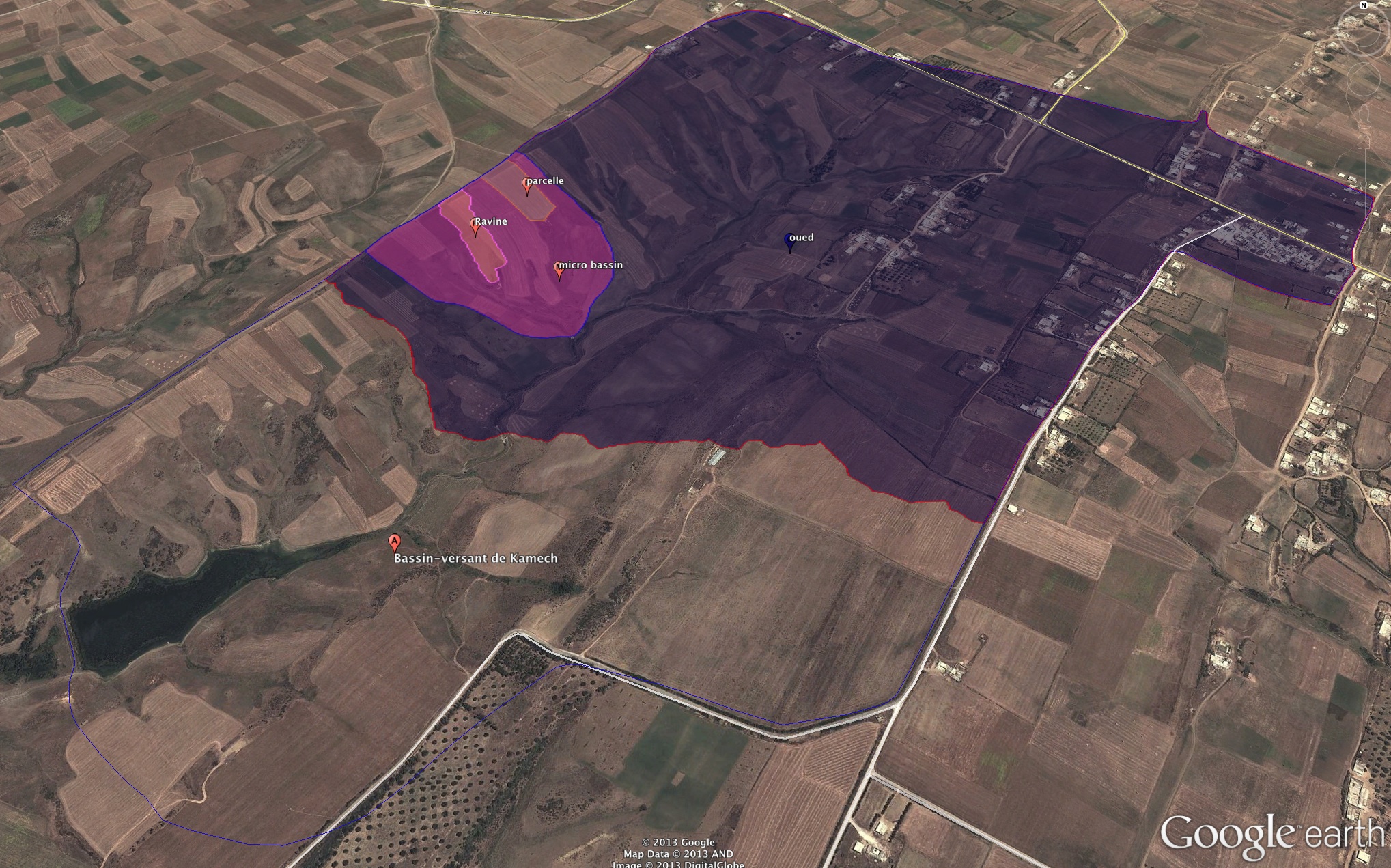
map of the impluviums (monitored sub-catchments) of the Kamech catchment area
Limits of the impluviums of :
- the wadi
- the agronomic plot
- the gully
- the Kamech micro-basin
Simple
- Date ( Creation )
- 2008-01-01
- Date ( Revision )
- 2008-01-01
- Identifier
- kamech_carte_des_impluvi_20131203_113800
https://www.umr-lisah.fr/?q=fr/content/o-grunberger
- Maintenance and update frequency
- As needed
- GEMET - INSPIRE themes, version 1.0 GEMET - INSPIRE themes, version 1.0 ( Theme )
-
- Hydrographie
- UNESCO Thesaurus UNESCO Thesaurus ( Theme )
-
- Hydrographs
- Hydrology
- Water discharge
Resource constraints
- Access constraints
- Intellectual property rights
- Use limitation
- Free use subject to compliance with the OMERE Observatory data use charter available on this form and also digitally signed when downloading data via the OMERE portal.
- Spatial representation type
- Vector
- Distance
- 2 metres
- Denominator
- 1000
- Metadata language
- fre
- Topic category
-
- Environment
- Imagery base maps earth cover
- Boundaries
- Description
- Kamech (Tunisie)
))
- Reference system identifier
- Carthage /Lambert Nord Tunisie (EPSG 22391) /
- Geometric object type
- Surface
- Distribution format
-
-
Kamech : carte des impluviums du bassin versant de kamech
(
2008-01-01T12:00:00
)
- Specification
- Shape au format shp.
-
Kamech : carte des impluviums du bassin versant de kamech
(
2008-01-01T12:00:00
)
- OnLine resource
- Charter for the use of OMERE Observatory data ( WWW:LINK-1.0-http--link )
- OnLine resource
- impluviumkamech.zip ( WWW:DOWNLOAD-1.0-http--download )
- OnLine resource
-
limit_kamech_ltn
(
OGC:WMS-1.1.1-http-get-capabilities
)
Geographical layer of the contour of the Kamech catchment area
- OnLine resource
-
ka_impluviumKamech
(
OGC:WMS-1.1.1-http-get-capabilities
)
geographical layer of the impluviums of the Kamech catchment area
- Hierarchy level
- Dataset
Conformance result
- Date ( Publication )
- 2010-05-03
- Explanation
- Non evalue
- Statement
- Délimitation des impluvium du bassin versant de kamech par ???
- Description
-
Limits of the impluviums of :
- the wadi
- the agronomic plot
- the gully
- the Kamech micro-basin
- File identifier
- 6fcb055b-2efe-4eea-b380-22881858cf47 XML
- Metadata language
- fre
- Character set
- UTF8
- Parent identifier
- KAMECH long-term monitoring system (Cap Bon / Tunisie) 8995bb85-af1e-487d-8118-a01fb5fcdeb1
- Hierarchy level
- Dataset
- Hierarchy level name
- Données géographiques
- Date stamp
- 2021-04-13T13:42:04
- Metadata standard name
- ISO 19115:2003/19139
- Metadata standard version
- 1.0
https://www.umr-lisah.fr/?q=fr/content/a-dubreuil
Overviews
Spatial extent
Provided by
