 Catalalogue de l'ORE OMERE
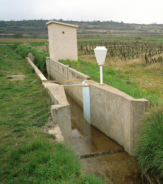
Rainfall measurement (Roujan)
The rainfall of the Roujan (Hérault) catchment area has been acquired since 1992 through various measuring points on which sensors are positioned on a long-term and continuous basis.
The data from these sensors are directly recorded on servers in Montpellier through remote transmission.
Verification treatments and possible corrections are applied before the data sets are integrated into the HYSAE database.
Through the OMERE data portal accessible from this sheet, the data can be downloaded from an interactive map.
In addition to these raw data rainfall records, a so-called "synthetic" time serie is elaborated to provide a complete and uninterrupted chronicle of rainfall data representative for the catchment area.
Simple
- Date ( Creation )
- Date ( Publication )
- Date ( Revision )
- Status
- On going
https://www.umr-lisah.fr/?q=fr/content/c-coulouma
- Keywords
-
- Keywords
-
- thesaurus_localisation_omere ( Place )
-
- Roujan
- GEMET - INSPIRE themes, version 1.0 ( Theme )
-
- Environmental monitoring facilities
- UNESCO Thesaurus ( Theme )
-
- Rain
- Precipitation
- Surface water
- Water balance
- Hydrological cycle
- Water resources
- Hydrological measurement
- Access constraints
- Intellectual property rights
- Use limitation
- Free use subject to compliance with the OMERE Observatory data use charter available on this form and also digitally signed when downloading data via the OMERE portal.
- Description
- Roujan
))
- Distribution format
-
-
utf8
(
1
)
-
utf8
(
1
)
- OnLine resource
- Roujan data portal ( WWW:LINK-1.0-http--link )
- OnLine resource
-
roucnt21311_l93
(
OGC:WMS-1.3.0-http-get-capabilities
)
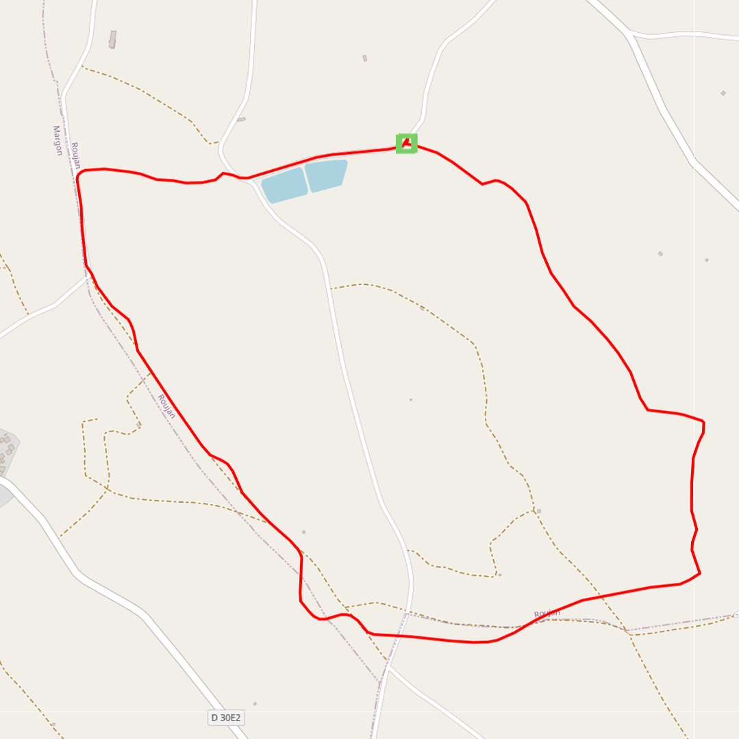
Geographical layer of the contour of the Roujan catchment area
- OnLine resource
- Charter for the use of OMERE Observatory data ( WWW:LINK-1.0-http--link )
- OnLine resource
-
fr_pluie
(
OGC:WMS-1.1.1-http-get-capabilities
)
Geographical layer of rain measurement points on Roujan
- File identifier
- a5d3cc01-83a6-43f1-bf33-d3646391b8dc XML
- Metadata language
- fr
- Parent identifier
- Observation site of the Roujan's catchment (Herault / France) 1c37c878-e4cc-4137-8556-11561b4d91a1
- Date stamp
- 2021-03-12T13:53:56
https://www.umr-lisah.fr/?q=fr/content/a-dubreuil
Overviews
Spatial extent
Provided by
