 Catalalogue de l'ORE OMERE
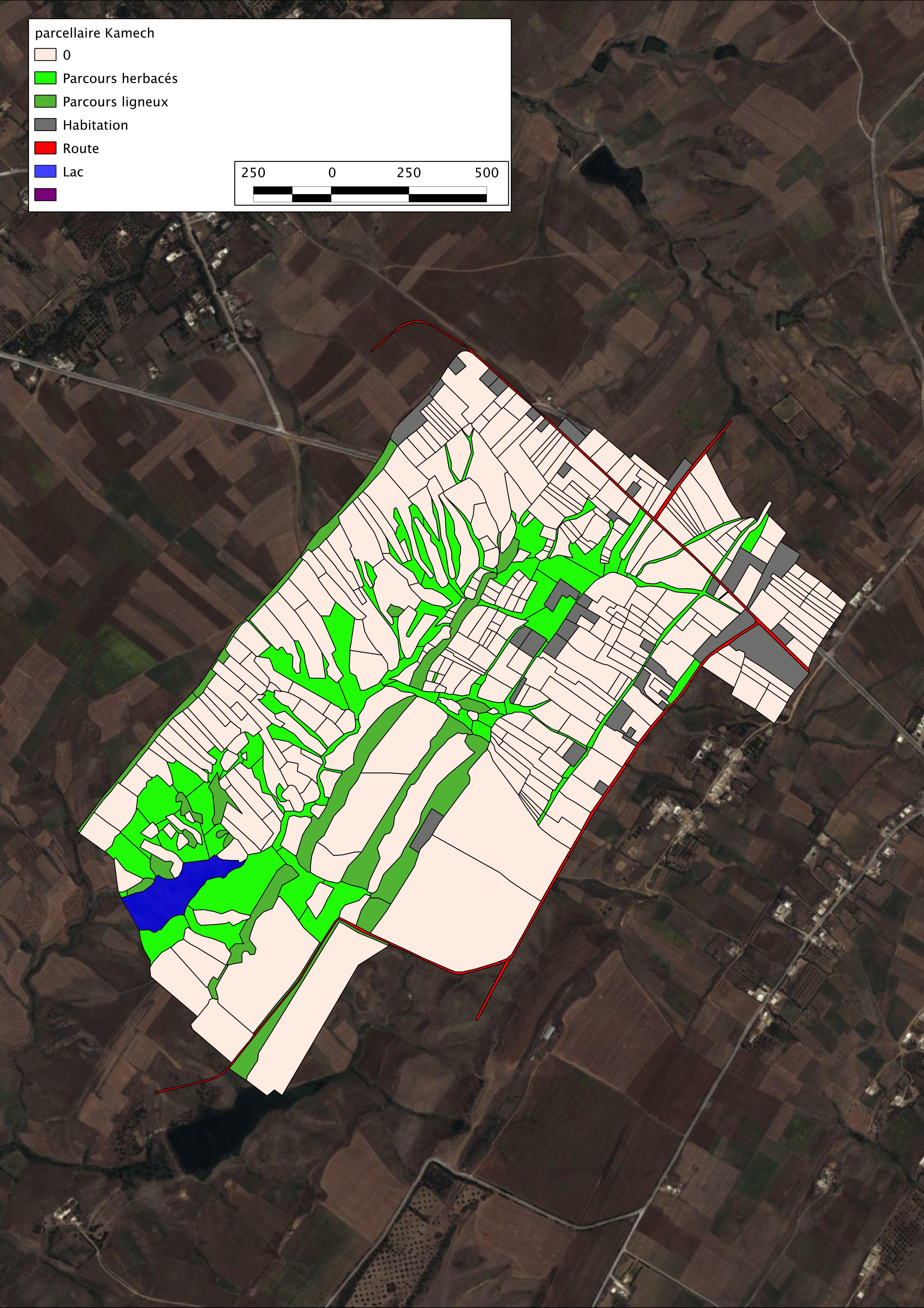
Parcellaire cultural de la période 2008-2010 (Kamech)
cartographie du parcellaire de Kamech réalisé à partir des observation effectué par Zakia Jenhaoui recensant les propriétaires, les exploitants et l'occupation du sol sur la période de 2008 à 2010
Simple
- Date ( Creation )
- 2008-01-01
- Date ( Revision )
- 2011-01-01
- Identifier
- kamech_parcellaires_de_k_20131203_143249
Custodian
IRD - OG
-
Kamech site manager
(
Administrateur du Système d'Informations
)
https://www.umr-lisah.fr/?q=fr/content/o-grunberger
43 Avenue Charles Nicolle
,
INAT Tunisie
,
Tunis
,
1082
,
Tunisia
+216(0)92 643 163
https://www.umr-lisah.fr/?q=fr/content/o-grunberger
Principal investigator
ORE OMERE
-
Scientific Coordinators
(
Scientific coordination of the Observatory
)
2, place Pierre Viala
,
Bâtiment 24
,
Montpellier
,
34060
,
France
https://www.obs-omere.org/fr/organisation
- Maintenance and update frequency
- Not planned
- thesaurus_localisation_omere ( Place )
-
- Kamech
- theme.agricultral_land.rdf theme.agricultral_land.rdf ( Theme )
-
- Cultivation
- Agricultural land
- Agronomy
Resource constraints
- Access constraints
- Intellectual property rights
- Use limitation
- Free use subject to compliance with the OMERE Observatory data use charter available on this form and also digitally signed when downloading data via the OMERE portal.
- Access constraints
- Other restrictions
- Other constraints
- internal use
- Classification
- Restricted
- Spatial representation type
- Vector
- Distance
- 2 metres
- Denominator
- 5000
- Metadata language
- fre
- Description
- kamech
- Description
- Kamech
N
S
E
W
))
- Reference system identifier
- Carthage /Lambert Nord Tunisie (EPSG 22391) /
- Geometric object type
- Surface
- Distribution format
-
-
Kamech :Parcellaires de Kamech
(
2011-01-01T12:00:00
)
- Specification
- Shape au format shp.
-
Kamech :Parcellaires de Kamech
(
2011-01-01T12:00:00
)
- OnLine resource
- Charter for the use of OMERE Observatory data ( WWW:LINK-1.0-http--link )
- OnLine resource
-
limit_kamech_ltn
(
OGC:WMS-1.1.1-http-get-capabilities
)
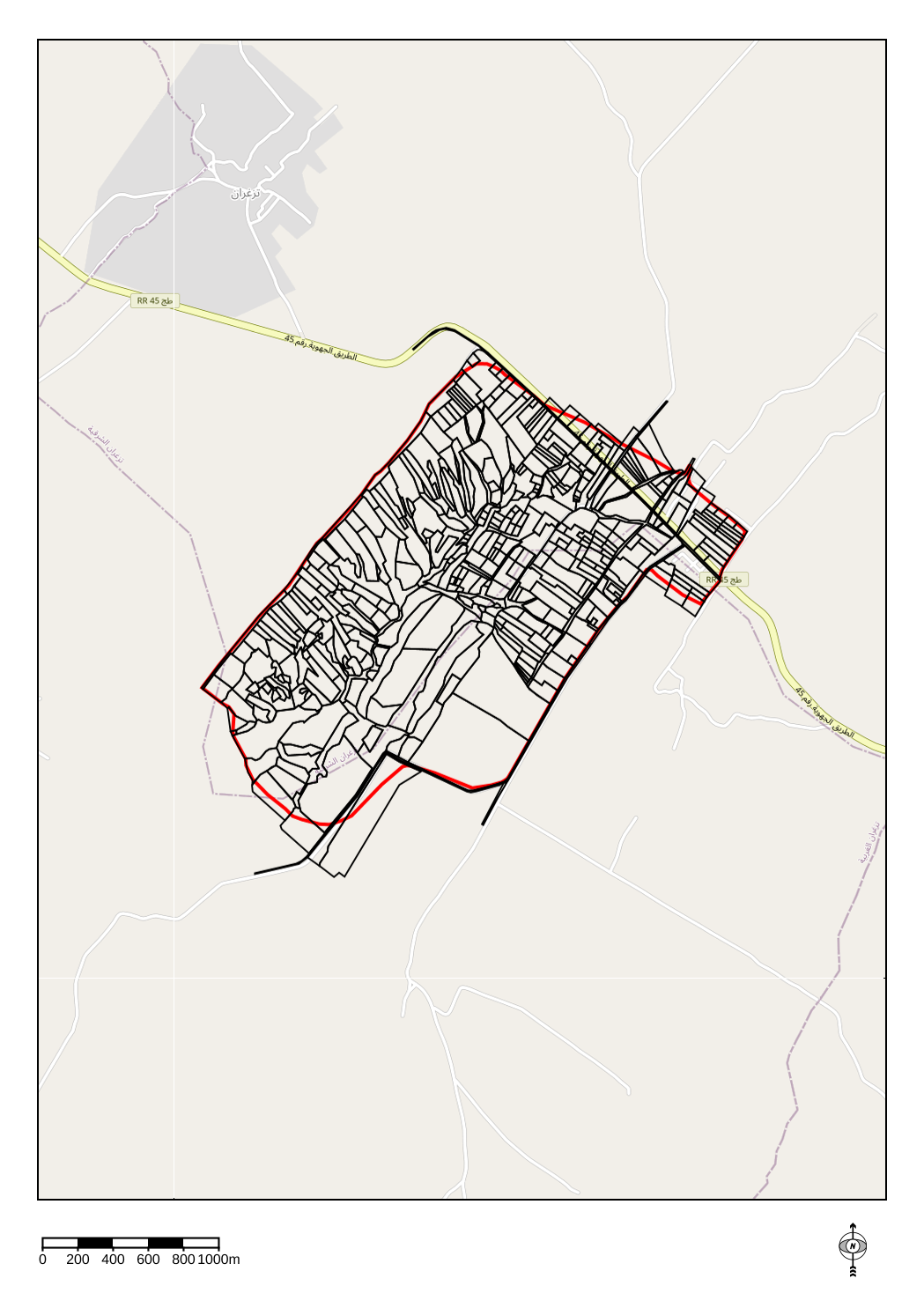
Geographical layer of the contour of the Kamech catchment area
- OnLine resource
- kamparc_2008_2010_ltn.zip ( WWW:DOWNLOAD-1.0-http--download )
- OnLine resource
-
tn_kamech:kamparc_2008_2010_ltn
(
OGC:WMS-1.1.1-http-get-capabilities
)
Cultural Parcellaire of the Kamech catchment area - 2008-2010
- Hierarchy level
- Dataset
Conformance result
- Date ( Publication )
- 2010-05-03
- Explanation
- Non evalue
- Statement
- updating of the attributes of the Kamech parcel layer, based on regular observations made by Zakia Jenhaoui
- Description
- mapping of the Kamech plot of land based on Zakia Jenhaoui's observations of owners, operators and land use over the period 2008 to 2010
- File identifier
- Expire_529ddbaa05ae8 XML
- Metadata language
- fr
- Character set
- UTF8
- Parent identifier
- KAMECH long-term monitoring system (Cap Bon / Tunisie) 8995bb85-af1e-487d-8118-a01fb5fcdeb1
- Hierarchy level
- Dataset
- Hierarchy level name
- Données géographiques
- Date stamp
- 2021-01-22T15:19:55
- Metadata standard name
- ISO 19115:2003/19139
- Metadata standard version
- 1.0
Metadata author
No information provided.
Custodian
INRAE - AD
-
Arnaud DUBREUIL
(
Information System Administrator
)
https://www.umr-lisah.fr/?q=fr/content/a-dubreuil
2, place Pierre Viala
,
Bâtiment 24
,
Montpellier
,
34060
,
France
+33499612347
https://www.umr-lisah.fr/?q=fr/content/a-dubreuil
Overviews
thumbnail8005320796559073381.png
large_thumbnail
Spatial extent
N
S
E
W
Provided by

Associated resources
Not available