 Catalalogue de l'ORE OMERE
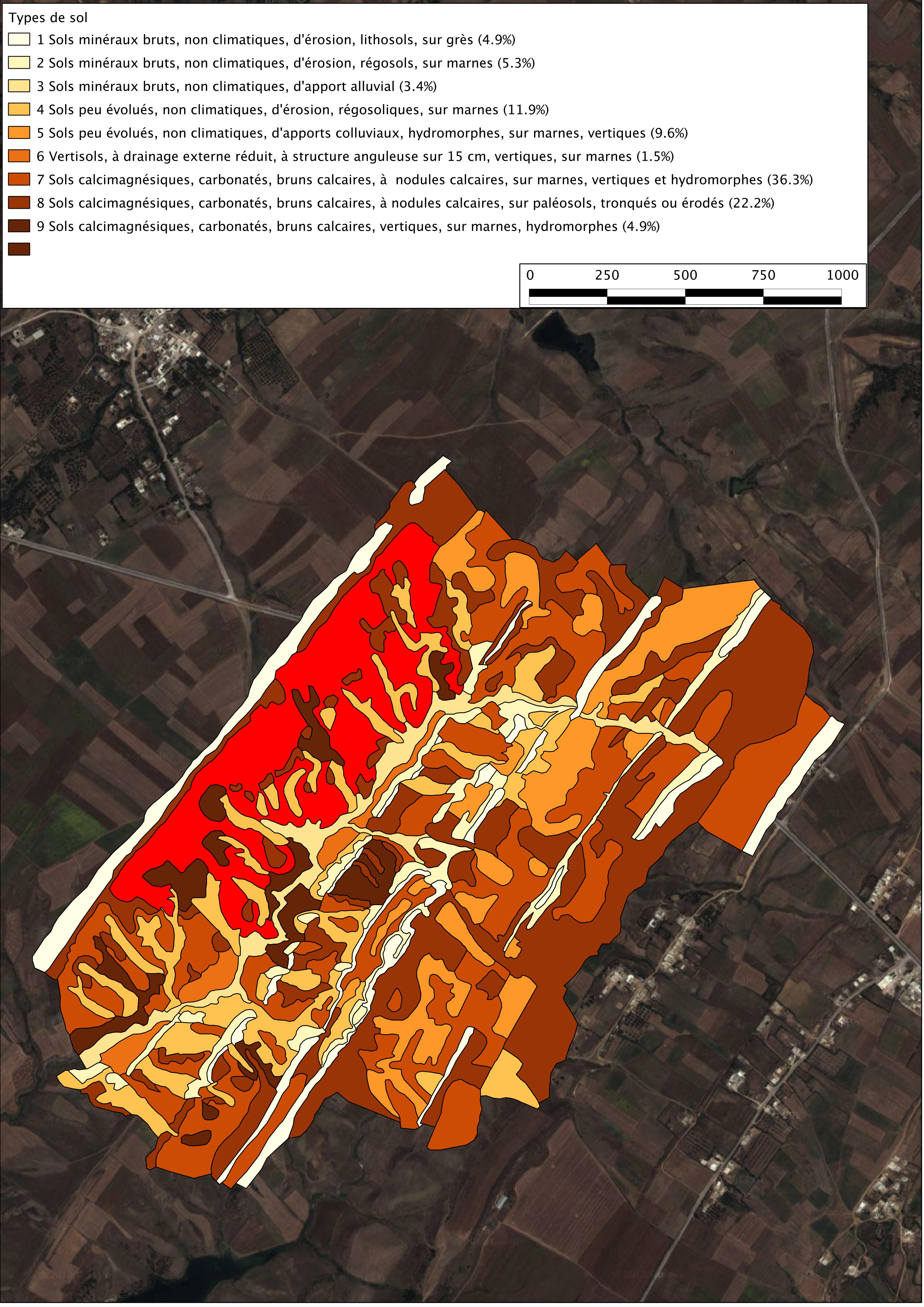
Soil map of the Kamech catchment area
soil map of the kamech watershed drawn up by P. Zante & J. Collinet in 2003 with the ancient french soil referential CPCS.
Simple
- Date ( Creation )
- 2003-01-01
- Date ( Revision )
- 2003-01-01
- Identifier
- carte_pedologique_de_kam_20131204_160503
Custodian
IRD - OG
-
Kamech site manager
(
Administrateur du Système d'Informations
)
https://www.umr-lisah.fr/?q=fr/content/o-grunberger
43 Avenue Charles Nicolle
,
INAT Tunisie
,
Tunis
,
1082
,
Tunisia
+216(0)92 643 163
https://www.umr-lisah.fr/?q=fr/content/o-grunberger
Principal investigator
ORE OMERE
-
Scientific Coordinators
(
Scientific coordination of the Observatory
)
2, place Pierre Viala
,
Bâtiment 24
,
Montpellier
,
34060
,
France
https://www.obs-omere.org/fr/organisation
- Maintenance and update frequency
- Unknown
- GEMET - INSPIRE themes, version 1.0 GEMET - INSPIRE themes, version 1.0 ( Theme )
-
- Soil
- Keywords
-
- UNESCO Thesaurus UNESCO Thesaurus ( Theme )
-
- Soil maps
- Soil sciences
- Soils
- Use limitation
- Utilisation libre sous réserve de mentionner la source (a minima OMERE) et la date de sa dernière mise à jour
- Access constraints
- Other restrictions
- Other constraints
- usage interne
- Classification
- Restricted
- Spatial representation type
- Vector
- Distance
- 2 metres
- Denominator
- 5000
- Metadata language
- fre
- Topic category
-
- Farming
- Environment
- Imagery base maps earth cover
- Description
- Kamech (Tunisie)
N
S
E
W
))
- Reference system identifier
- Carthage /Lambert Nord Tunisie (EPSG 22391) /
- Geometric object type
- Surface
- Distribution format
-
-
carte pédologique de Kamech
(
2003-01-01T12:00:00
)
- Specification
- Shape au format shp.
-
carte pédologique de Kamech
(
2003-01-01T12:00:00
)
- OnLine resource
- Charter for the use of OMERE Observatory data ( WWW:LINK-1.0-http--link )
- OnLine resource
- Pedo_kamech_2005.pdf ( WWW:DOWNLOAD-1.0-http--download )
- OnLine resource
-
limit_kamech_ltn
(
OGC:WMS-1.1.1-http-get-capabilities
)
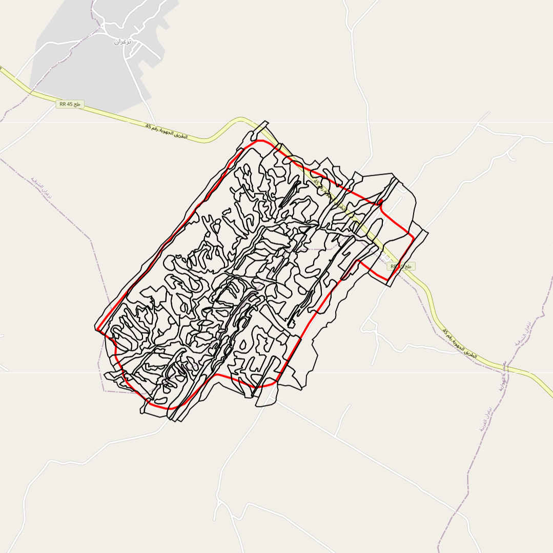
Geographical layer of the contour of the Kamech catchment area
- OnLine resource
-
pedo_2003_ltn
(
OGC:WMS-1.1.1-http-get-capabilities
)
geographical layer of the soil map of Kamech made in 2003
- Hierarchy level
- Dataset
Conformance result
- Date ( Publication )
- 2010-05-03
- Explanation
- Non evalue
- Statement
- carte pédologique dressé par P. Zante en 2003
- Description
- carte pédologique du bassin versant de kamech dressé par P. Zante en 2003
- File identifier
- 0b23a416-3672-4529-82c9-12425a646556 XML
- Metadata language
- fre
- Character set
- UTF8
- Parent identifier
- KAMECH long-term monitoring system (Cap Bon / Tunisie) 8995bb85-af1e-487d-8118-a01fb5fcdeb1
- Hierarchy level
- Dataset
- Hierarchy level name
- Données géographiques
- Date stamp
- 2021-04-13T13:14:36
- Metadata standard name
- ISO 19115:2003/19139
- Metadata standard version
- 1.0
Point of contact
IRD
-
BLANCA Yves
(
administrateur de données (Tunisie)
)
2 place VIALA
,
Montpellier
,
34060
,
France
0499612550
Overviews
large_thumbnail
Spatial extent
N
S
E
W
Provided by

Associated resources
Not available