 Catalalogue de l'ORE OMERE
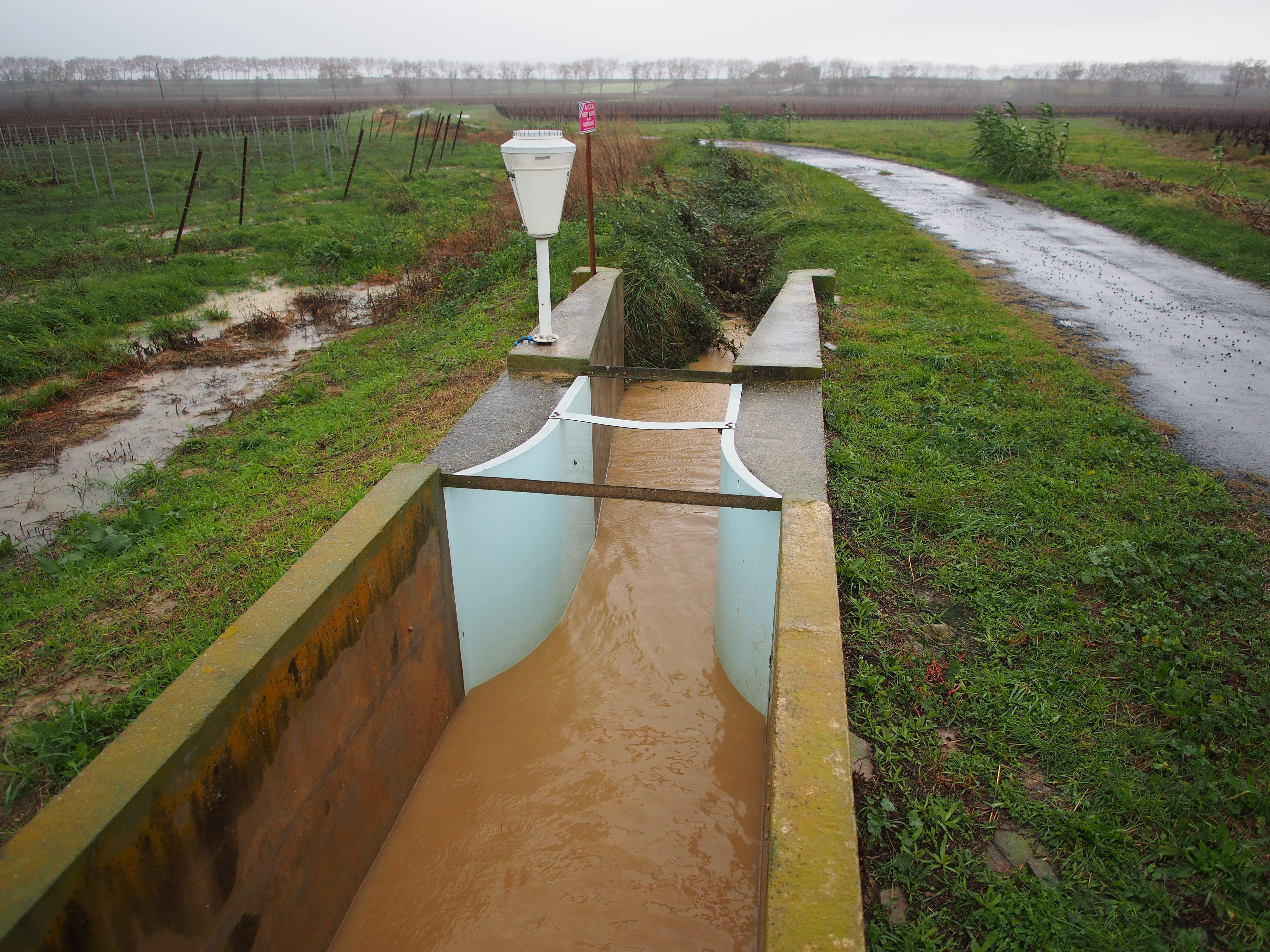
Runoff and stream flow measurement (Roujan)
Runoff and stream flow discharge monitoring in the Roujan catchment area (Hérault) is operational since 1992 at catchment and sub-catchments hydrological stations on which automatic sensors records water level time series on a long-term and continuous basis.
The data from these sensors are collected and instantaneously transmitted to servers in Montpellier.
Verification and correction processes on the raw data, as well as the generation of elaborated data (e.g. calculation of flows from water heights or modification of time steps) are applied before integration of the data sets into the HYSAE database.
The water level and discharge time series can be downloaded from an interactive map through the OMERE data portal accessible from this page.
Simple
- Date ( Creation )
- Date ( Publication )
- Date ( Revision )
- Status
- On going
https://www.umr-lisah.fr/?q=fr/content/c-coulouma
- Keywords
-
- Keywords
-
- thesaurus_localisation_omere ( Place )
-
- Roujan
- GEMET - INSPIRE themes, version 1.0 ( Theme )
-
- Environmental monitoring facilities
- theme.hydrology_unesco.rdf ( Theme )
-
- Water supply
- Hydrological cycle
- Water resources
- Surface water
- Ecohydrology
- Water balance
- Hydrological measurement
- Hydrology
- Hydrological research
- Earth sciences
- Fluid mechanics
- UNESCO Thesaurus UNESCO Thesaurus ( Theme )
-
- Hydrological data
- Flow
- Hydrodynamics
- Hydrological cycle
- Water resources
- Ecohydrology
- Water balance
- Water supply
- Surface water
- Hydrological research
- Hydrology education
- Hydrological measurement
- Hydrology
Resource constraints
- Access constraints
- Intellectual property rights
- Use limitation
- Free use subject to compliance with the OMERE Observatory data use charter available on this form and also digitally signed when downloading data via the OMERE portal.
- Description
- Roujan
))
- Distribution format
-
-
utf8
(
1
)
-
utf8
(
1
)
- OnLine resource
- Roujan data portal ( WWW:LINK-1.0-http--link )
- OnLine resource
- Charter for the use of OMERE Observatory data ( WWW:LINK-1.0-http--link )
- OnLine resource
-
roucnt21311_l93
(
OGC:WMS-1.3.0-http-get-capabilities
)
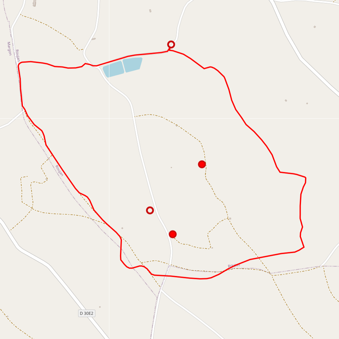
Geographical layer of the contour of the Roujan catchment area
- OnLine resource
-
fr_debit
(
OGC:WMS-1.1.1-http-get-capabilities
)
Geographical layer of measurement points related to runoff and flows in the Roujan catchment area
- File identifier
- de6e1566-a810-4401-a74c-10c991bc1f8a XML
- Metadata language
- fr
- Parent identifier
- Observation site of the Roujan's catchment (Herault / France) 1c37c878-e4cc-4137-8556-11561b4d91a1
- Date stamp
- 2022-10-25T10:45:50
https://www.umr-lisah.fr/?q=fr/content/a-dubreuil
Overviews
Spatial extent
Provided by
